Rediscovering the Citadel
- | Tanvir Hasan

Over the last three years Donald lnsall Associates has become involved in a number projects with the World Monument Fund.
We were contacted in 2018 to assist with a project with the University of Duhok in Kurdistan. Our role was to work with students and faculty of the University to produce a Conservation Management Plan for the city Amedy.
Amedy
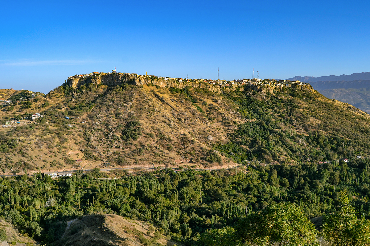
Amedy is a citadel town perched on top of an outcrop in the semi-autonomous Kurdish region of Northern Iraq, located in the Tigris River plain in the Sepna and Gomel River valleys. Although the earliest written records of the city date to 9thC BC, it is better known as the capital of the Bahdinan Emirate (1300-1843). Under Bahdinan power Amedy also served as a leading trading post in the region, and its influence extended west to Zakho and south to parts of Mosul and Erbil Governorates.
Throughout is long history Amedy and its surrounding region has been home to successive religions including Zoroastrianism, Mithraism, Judaism, Christianity, and Islam. Until the midtwentieth century, the city of Amedy also enjoyed a rich religious diversity split equally between its population of Christians, Muslims and Jews.
The different religious groups occupied particular areas of the city and these areas had churches, synagogues and mosques to serve their religious needs. In the mid 1950s many of the Jews of Amedy migrated to Israel, leaving the city inhabited by a majority population of Kurdish Sunni Muslims and a minority of Catholic and Protestant Christians.
Modern Amedy

In the 1930s a wide motor road was constructing leading up to the “citadel” of Amedy on the hill, breaking through the wall on the south eastern edge of the city. From the 1930s onwards arrival was no longer through the two ancient gates into the Bazaar Street. but via a roundabout which remains in use today. To use a car in the city required wider streets, so a ring road was laid out and the narrow stepped streets were reengineered to form slopes for vehicular traffic.
The wide road destroyed the historical grain of parts of the city, and reduced the dominance of the Bazaar Street. Today it would be difficult to find a route to the bazaar were it not for the presence of the 15th Century minaret. which falls on the historic line between the lost Zebar Gate and the bazaar.
Much of the change which followed was the result of easier access. A city once accessible only by horse or on foot could now be reached more easily by car. If getting to Amedy was easier then leaving it was also easier, and slowly the population of the town moved out to bigger and more modern centres in the region, and the houses were abandoned.
Heritage in Kurdistan
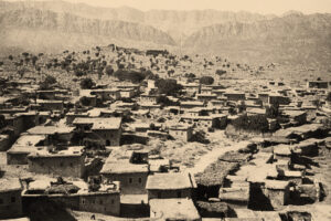
Today Amedy faces a number of pressures as it struggles to become a financially viable town. Much of the historic residential buildings of the town have been lost all together, or replaced with higher modern versions in cement. The majority of bazaar has been replaced by modern concrete structures with residential units above. Much of the original grain of the city still remains, although many of the traditional houses are now rubble.
With the creation of Kurdistan there is also a desire from the local government to establish its historic roots in ancient towns like Amedy.
Amedy as a Model for the Region
There is recognition in Iraqi Kurdistan that their built heritage is being lost, and a willingness to slow that decline. Heritage is being lost is due to migration of people, conflict, and also due to a lack of professional expertise and an erosion of technical skills.
A significant number of the issues facing the region are present in Amedy, which makes it an ideal candidate for a conservation management plan. It is the intention of the local government that this serve as a model for the region in order to better preserve heritage assets.
At the heart of the loss of historic fabric lies the inability to repair, restore and regenerate the historic fabric effectively. The local government has no established methodology by which it can control development. or preserve and revitalize its historic structures without demolishing and rebuilding them completely.
Working with Duhok University

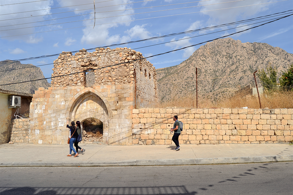
The ruins of a residence dated to the 13thC on stylistic grounds. The fine carving still visible, at the base of the entrance arch even though the raised road level makes this entrance impossible to use.
The University of Duhok was called upon by the local government of Amedy to assist with the creation of framework which would help it with managing its historic town. The university identified a lack of conservation expertise within the region, in two principal areas: a lack of understanding of the key principles of conservation among design professionals and the erosion of conservation techniques and skills among construction professionals and craftspeople.
The World Monument Fund (WMF) established a working relationship with Duhok University to provide this expertise, and WMF assembled a team including a landscape architect, a community engagement expert and Donald lnsall Associates as conservation architects, to work together on the project. The team from Duhok University included students, architects and lecturers.
In early discussions the Dohuk team concluded that the best way to document the problems which Amedy faces and in turn find pragmatic conservation solutions was via a conservation management plan. Due to the limited time scale of the project, lnsall’s work concentrated on working with the Iraqi team to agree conservation methodologies for different types of heritage assets.
These sites were chosen in recognition of the range of heritage problems that were embodied within them. It is hoped that the analysis of the typologies identified in the Conservation Management Plan, supported by further research, will allow a series of opportunities and design codes to be developed.
One positive outcome of this very short project is that several of the students on the team have continued to take greater interest in the restoration and reuse of historic buildings, and it is hoped that this interest lasts.
